


Gatineau River: Then and Now
Lower Gatineau River from the air in 1926 and 1997
Set 18 - Wakefield village (Click on images for additional details)
These two vertical views highlight some of the many ways central Wakefield changed over the 69 years from 1926 to 1995. In the THEN photo there is no evidence of Valley Drive; the route from Wakefield to Masham was via Mill Road. Sully's sawmill once stood near the site NOW of the Alpengruss Restaurant and railway turntable.
Then image (click)
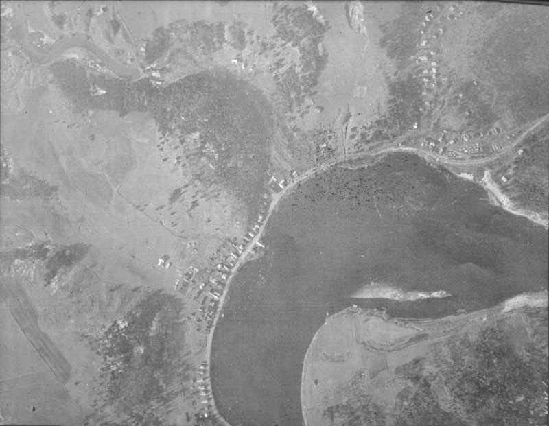
Wakefield village
Now image (click)
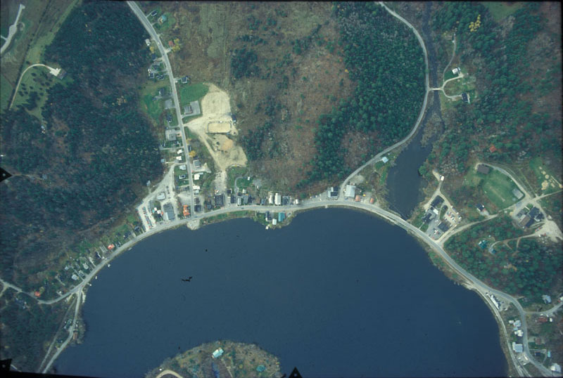
Wakefield village